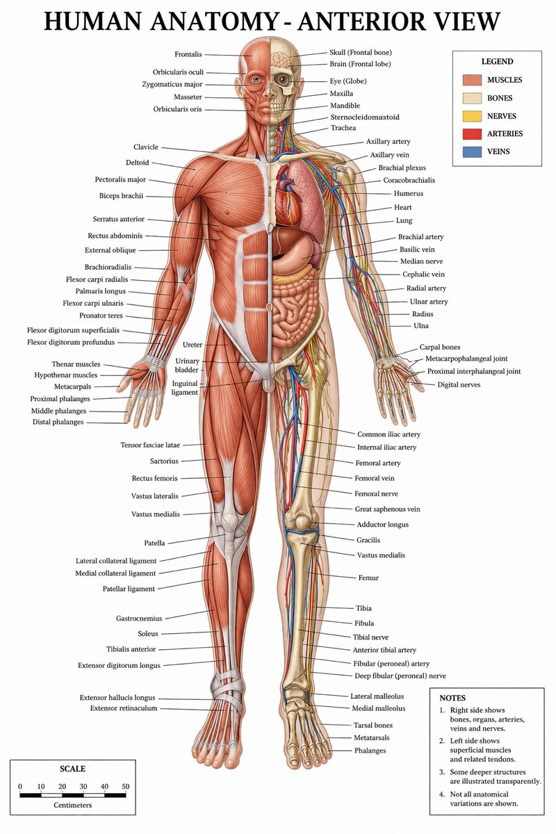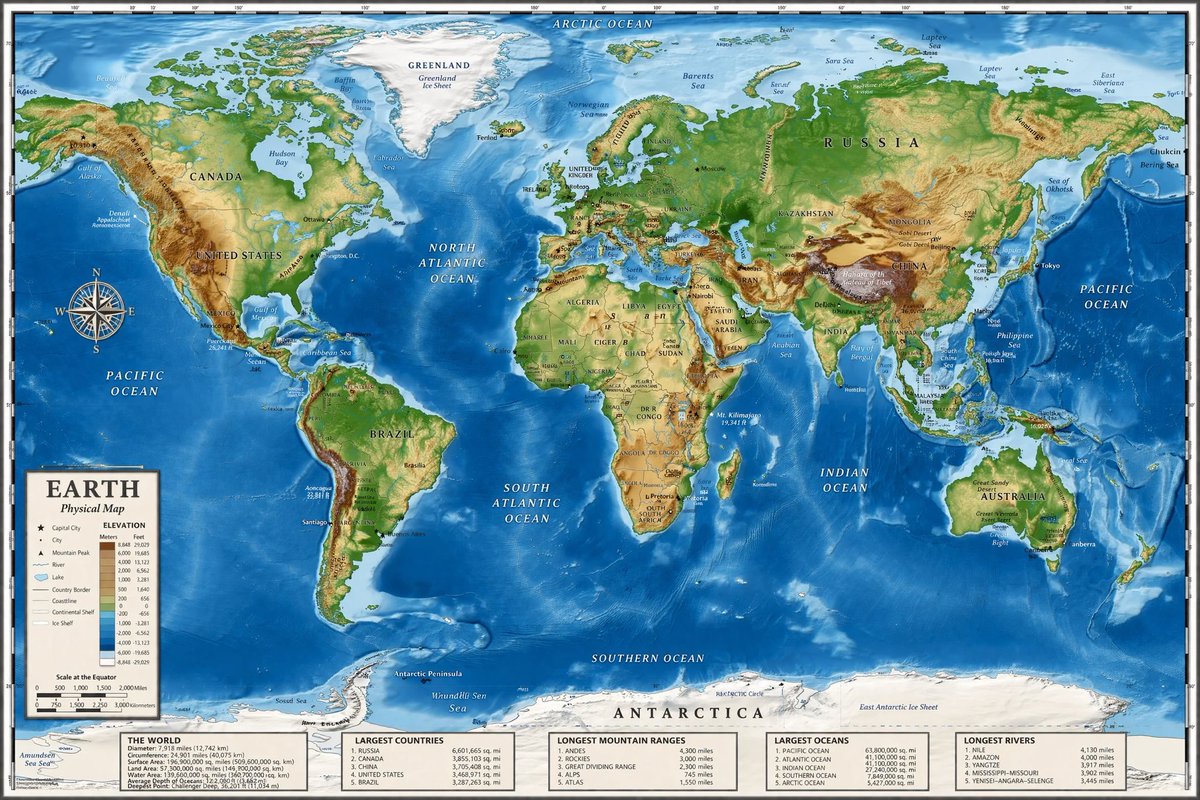
带有信息面板的详细物理世界地图
生成一张高度详细的地形世界地图,包含图例、罗盘玫瑰以及底部的五个信息数据面板。
- Category
- Charts & Infographics
- Model
- GPT Image 2
- Creator
- すぐる | ChatGPTガチ勢 𝕏
- Source language
- en
- Source ID
- 14075
- Published
- Apr 15, 2026
Full prompt
{
  "type": "highly detailed cartographic world map",
  "style": "{argument name=\"color palette\" default=\"realistic topographical and bathymetric colors\"}",
  "map_features": {
    "terrain": "shaded relief showing mountains, valleys, and plains in greens, browns, and whites",
    "oceans": "depth shading in various tones of blue, with lighter blues for continental shelves and darker blues for deep trenches",
    "grid": "latitude and longitude lines spanning the entire map",
    "labels": "major continents, countries, oceans, and seas clearly labeled in serif and sans-serif typography"
  },
  "layout": {
    "overlays": [
      {
        "type": "compass rose",
        "position": "mid-left, over the Pacific Ocean",
        "description": "classic 8-point nautical compass"
      },
      {
        "type": "legend",
        "position": "bottom left",
        "title": "{argument name=\"map title\" default=\"EARTH\"}",
        "subtitle": "{argument name=\"map type\" default=\"Physical Map\"}",
        "contents": "elevation color key, map symbols, and distance scale"
      }
    ],
    "bottom_panels": {
      "count": 5,
      "position": "horizontal row along the bottom edge",
      "labels": [
        "THE WORLD",
        "LARGEST COUNTRIES",
        "LONGEST MOUNTAIN RANGES",
        "LARGEST OCEANS",
        "LONGEST RIVERS"
      ]
    }
  }
}
Translations
带有信息面板的详细物理世界地图
en{ "type": "highly detailed cartographic world map", "style": "{argument name=\"color palette\" default=\"realistic topographical and bathymetric colors\"}", "map_features": { "terrain": "shaded relief showing mountains, valleys, and plains in greens, browns, and whites", "oceans": "depth shading in various tones of blue, with lighter blues for continental shelves and darker blues for deep trenches", "grid": "latitude and longitude lines spanning the entire map", "labels": "major continents, countries, oceans, and seas clearly labeled in serif and sans-serif typography" }, "layout": { "overlays": [ { "type": "compass rose", "position": "mid-left, over the Pacific Ocean", "description": "classic 8-point nautical compass" }, { "type": "legend", "position": "bottom left", "title": "{argument name=\"map title\" default=\"EARTH\"}", "subtitle": "{argument name=\"map type\" default=\"Physical Map\"}", "contents": "elevation color key, map symbols, and distance scale" } ], "bottom_panels": { "count": 5, "position": "horizontal row along the bottom edge", "labels": [ "THE WORLD", "LARGEST COUNTRIES", "LONGEST MOUNTAIN RANGES", "LARGEST OCEANS", "LONGEST RIVERS" ] } } }
带有信息面板的详细物理世界地图
zh-CN{ "type": "高度详细的制图世界地图", "style": "{argument name=\"color palette\" default=\"逼真的地形和测深色彩\"}", "map_features": { "terrain": "阴影浮雕,以绿色、棕色和白色显示山脉、山谷和平原", "oceans": "不同色调的蓝色深度阴影,浅蓝色代表大陆架,深蓝色代表深海沟", "grid": "覆盖整个地图的经纬线", "labels": "主要大洲、国家、海洋和海域,以衬线和无衬线字体清晰标注" }, "layout": { "overlays": [ { "type": "罗盘玫瑰", "position": "中左侧,位于太平洋上方", "description": "经典的 8 向航海罗盘" }, { "type": "图例", "position": "左下角", "title": "{argument name=\"map title\" default=\"地球\"}", "subtitle": "{argument name=\"map type\" default=\"物理地图\"}", "contents": "海拔颜色键、地图符号和距离比例尺" } ], "bottom_panels": { "count": 5, "position": "沿底部的水平行", "labels": [ "世界概况", "最大国家", "最长山脉", "最大海洋", "最长河流" ] } } }