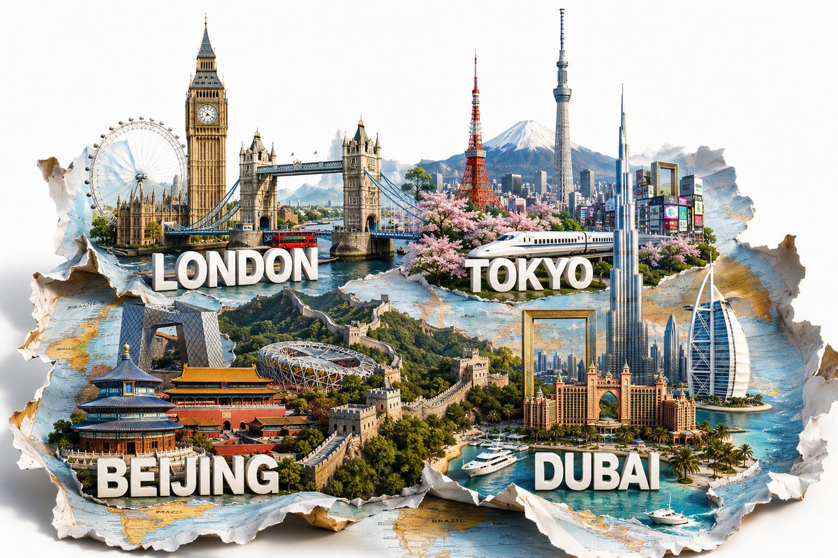
东京夜景立体模型地图
生成一张电影质感的东京 3D 微缩夜景地图,包含标注地标、发光的城市基础设施以及档案级制图风格。
- Category
- Charts & Infographics
- Model
- GPT Image 2
- Creator
- Tia
- Source language
- en
- Source ID
- 23071
- Published
- May 28, 2026
Full prompt
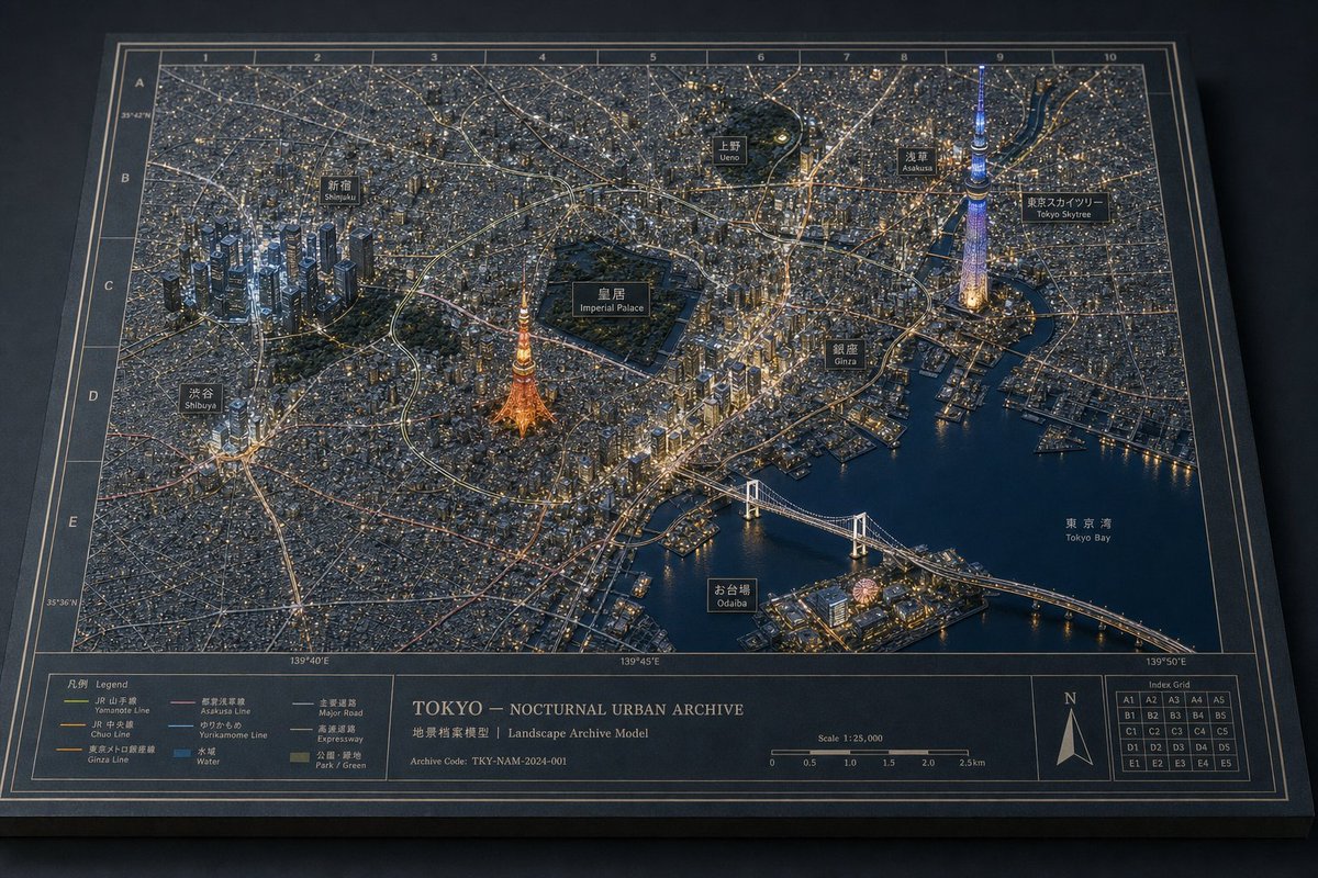
Goal: Create a highly detailed 3D miniature diorama map titled {argument name="map title" default="TOKYO — NOCTURNAL URBAN ARCHIVE"}, showing Tokyo at night as a physical architectural landscape archive model with glowing city lights, raised buildings, roads, rail lines, waterways, and landmark labels.

Canvas: Landscape 3:2 composition, viewed from an elevated oblique angle like a museum display table. The map sits on a dark tabletop as a thick rectangular board with beveled edges, a dark navy-black base, thin cream border lines, and a printed coordinate grid.

Main scene: A dense nocturnal cityscape of {argument name="city" default="Tokyo"} rendered as a miniature urban model. Use thousands of tiny buildings and warm window lights, fine street networks, rail corridors, expressways, and dark blue water surfaces. The overall feeling should be a premium physical map texture, not a flat digital map: raised terrain-like urban fabric, tiny architectural blocks, engraved labels, and realistic depth.

Landmarks and labels: Include exactly 10 black label plaques with bilingual Japanese/English styling, placed over the city: 1) Shinjuku, 2) Ueno, 3) Asakusa, 4) Tokyo Skytree, 5) Imperial Palace, 6) Shibuya, 7) Tokyo Tower, 8) Ginza, 9) Odaiba, 10) Tokyo Bay. Make Tokyo Tower glow orange near the center-left, Tokyo Skytree glow blue-violet on the right, the Imperial Palace appear as a large dark green park enclosure near the center, and Rainbow Bridge span the bay in the lower right.

Grid and map markings: Add a printed grid around the map with numbered columns 1 through 10 along the top and lettered rows A through E down the left side. Add subtle latitude and longitude markings along the edges. Use thin cream cartographic lines and small technical annotations.

Bottom information band: Along the bottom edge, create a wide printed legend and archive panel divided into sections. Include exactly 6 legend line items with colored line samples: 1) Yamanote Line, 2) Chuo Line, 3) Ginza Line, 4) Asakusa Line, 5) Yurikamome Line, 6) Water. Include a center title block reading {argument name="map title" default="TOKYO — NOCTURNAL URBAN ARCHIVE"}, with subtitle text “Landscape Archive Model” and archive code {argument name="archive code" default="TKY-NAM-2024-001"}. Add a scale bar labeled 1:25,000 and a north arrow in the lower right. Add a small index grid with cells labeled A1 through E5.

Visual style: Cinematic macro photography of a handcrafted architectural model, ultra-detailed, sharp foreground, slight atmospheric haze, realistic miniature lighting, warm gold and cool blue contrast, premium museum exhibit aesthetics, dark navy and charcoal color palette with cream typography. Emphasize layered landmarks, physical map textures, and consistent architectural-diorama language.

Constraints: Keep the image free of people and vehicles as dominant subjects. Do not add extra landmark labels beyond the 10 listed. Avoid cartoon styling, flat infographic aesthetics, or modern app UI elements. Make all text appear printed or as small physical plaques on the map board.
Translations
东京夜景立体模型地图
enGoal: Create a highly detailed 3D miniature diorama map titled {argument name="map title" default="TOKYO — NOCTURNAL URBAN ARCHIVE"}, showing Tokyo at night as a physical architectural landscape archive model with glowing city lights, raised buildings, roads, rail lines, waterways, and landmark labels. Canvas: Landscape 3:2 composition, viewed from an elevated oblique angle like a museum display table. The map sits on a dark tabletop as a thick rectangular board with beveled edges, a dark navy-black base, thin cream border lines, and a printed coordinate grid. Main scene: A dense nocturnal cityscape of {argument name="city" default="Tokyo"} rendered as a miniature urban model. Use thousands of tiny buildings and warm window lights, fine street networks, rail corridors, expressways, and dark blue water surfaces. The overall feeling should be a premium physical map texture, not a flat digital map: raised terrain-like urban fabric, tiny architectural blocks, engraved labels, and realistic depth. Landmarks and labels: Include exactly 10 black label plaques with bilingual Japanese/English styling, placed over the city: 1) Shinjuku, 2) Ueno, 3) Asakusa, 4) Tokyo Skytree, 5) Imperial Palace, 6) Shibuya, 7) Tokyo Tower, 8) Ginza, 9) Odaiba, 10) Tokyo Bay. Make Tokyo Tower glow orange near the center-left, Tokyo Skytree glow blue-violet on the right, the Imperial Palace appear as a large dark green park enclosure near the center, and Rainbow Bridge span the bay in the lower right. Grid and map markings: Add a printed grid around the map with numbered columns 1 through 10 along the top and lettered rows A through E down the left side. Add subtle latitude and longitude markings along the edges. Use thin cream cartographic lines and small technical annotations. Bottom information band: Along the bottom edge, create a wide printed legend and archive panel divided into sections. Include exactly 6 legend line items with colored line samples: 1) Yamanote Line, 2) Chuo Line, 3) Ginza Line, 4) Asakusa Line, 5) Yurikamome Line, 6) Water. Include a center title block reading {argument name="map title" default="TOKYO — NOCTURNAL URBAN ARCHIVE"}, with subtitle text “Landscape Archive Model” and archive code {argument name="archive code" default="TKY-NAM-2024-001"}. Add a scale bar labeled 1:25,000 and a north arrow in the lower right. Add a small index grid with cells labeled A1 through E5. Visual style: Cinematic macro photography of a handcrafted architectural model, ultra-detailed, sharp foreground, slight atmospheric haze, realistic miniature lighting, warm gold and cool blue contrast, premium museum exhibit aesthetics, dark navy and charcoal color palette with cream typography. Emphasize layered landmarks, physical map textures, and consistent architectural-diorama language. Constraints: Keep the image free of people and vehicles as dominant subjects. Do not add extra landmark labels beyond the 10 listed. Avoid cartoon styling, flat infographic aesthetics, or modern app UI elements. Make all text appear printed or as small physical plaques on the map board.
东京夜景立体模型地图
zh-CN目标:创建一个高度精细的 3D 微缩立体模型地图,标题为 {argument name="map title" default="TOKYO — NOCTURNAL URBAN ARCHIVE"},将东京呈现为一座夜间实体建筑景观档案模型,包含发光的城市灯光、凸起的建筑、道路、铁路线、水道和地标标签。 画布:3:2 横向构图,采用类似博物馆展示台的俯视斜角视角。地图置于深色桌面上,呈现为一个带有斜切边缘的厚矩形项目,底座为深海军蓝黑色,配有细奶油色边框和印刷坐标网格。 主场景:将 {argument name="city" default="Tokyo"} 的密集夜景渲染为微缩城市模型。使用数以千计的微小建筑和温暖的窗户灯光、精细的街道网络、铁路走廊、高速公路和深蓝色水面。整体质感应为高级实体地图,而非扁平的数字地图:具有凸起的类地形城市肌理、微型建筑块、雕刻标签和逼真的深度感。 地标与标签:包含 10 个黑色的双语(日文/英文)标签牌,放置在城市上方:1) 新宿 (Shinjuku),2) 上野 (Ueno),3) 浅草 (Asakusa),4) 东京晴空塔 (Tokyo Skytree),5) 皇居 (Imperial Palace),6) 涩谷 (Shibuya),7) 东京塔 (Tokyo Tower),8) 银座 (Ginza),9) 台场 (Odaiba),10) 东京湾 (Tokyo Bay)。让东京塔在左中位置发出橙色光芒,东京晴空塔在右侧发出蓝紫色光芒,皇居在中心附近呈现为大面积深绿色公园区域,彩虹大桥横跨右下方的海湾。 网格与地图标记:在地图周围添加印刷网格,顶部为 1 到 10 的数字列,左侧为 A 到 E 的字母行。边缘添加细微的经纬度标记。使用细奶油色制图线条和小型技术注释。 底部信息栏:沿底边创建一个宽大的印刷图例和档案面板,分为多个部分。包含 6 个带有彩色线条样本的图例项:1) 山手线 (Yamanote Line),2) 中央线 (Chuo Line),3) 银座线 (Ginza Line),4) 浅草线 (Asakusa Line),5) 百合海鸥线 (Yurikamome Line),6) 水域 (Water)。包含一个中心标题块,文字为 {argument name="map title" default="TOKYO — NOCTURNAL URBAN ARCHIVE"},副标题为“Landscape Archive Model”,档案代码为 {argument name="archive code" default="TKY-NAM-2024-001"}。右下角添加比例尺(1:25,000)和指北针。添加一个标注为 A1 到 E5 的小型索引网格。 视觉风格:手工建筑模型的电影级微距摄影,超精细,前景清晰,带有轻微的大气雾感,逼真的微缩照明,暖金色与冷蓝色的对比,高级博物馆展品美学,深海军蓝与炭灰色调,搭配奶油色字体。强调分层的地标、实体地图纹理以及统一的建筑立体模型语言。 约束:画面中不得出现作为主体的人物和车辆。除列出的 10 个地标外,不得添加额外标签。避免卡通风格、扁平信息图表美学或现代应用 UI 元素。所有文字应呈现为印刷效果或地图项目上的小型实体铭牌。