为历史航拍照片上色
此提示词可将黑白航拍照片转换为逼真的彩色版本,并以另一张航拍图作为色彩参考,适用于历史地图和地理可视化场景。
- Category
- Charts & Infographics
- Model
- GPT Image 2
- Creator
- まぬある
- Source language
- en
- Source ID
- 16056
- Published
- Apr 25, 2026
Full prompt
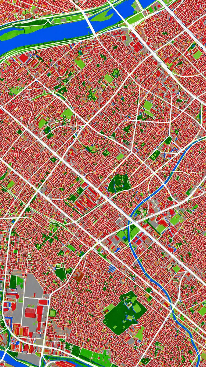
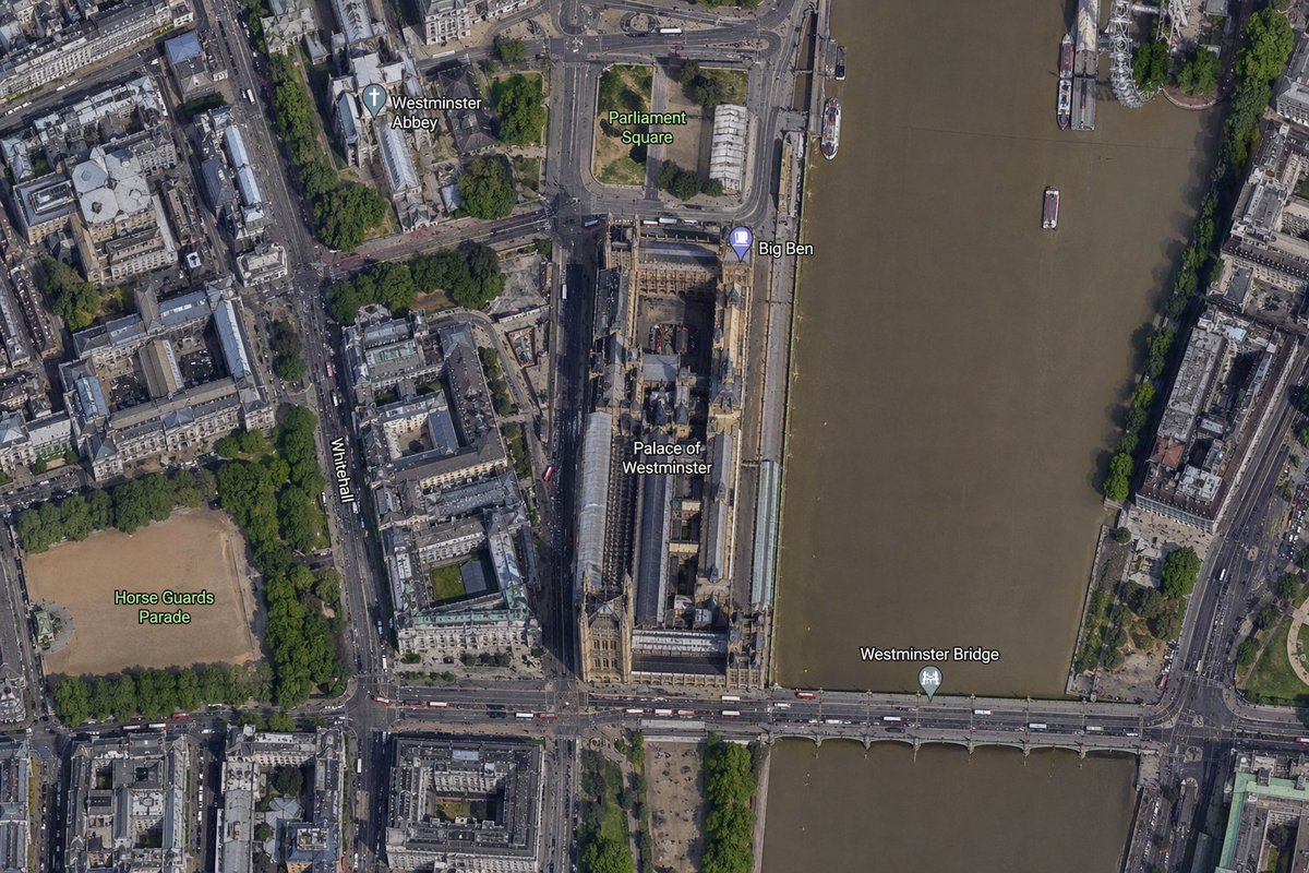
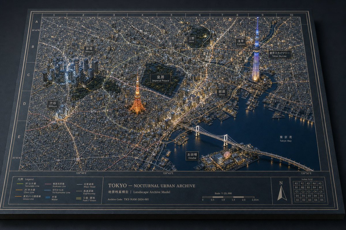
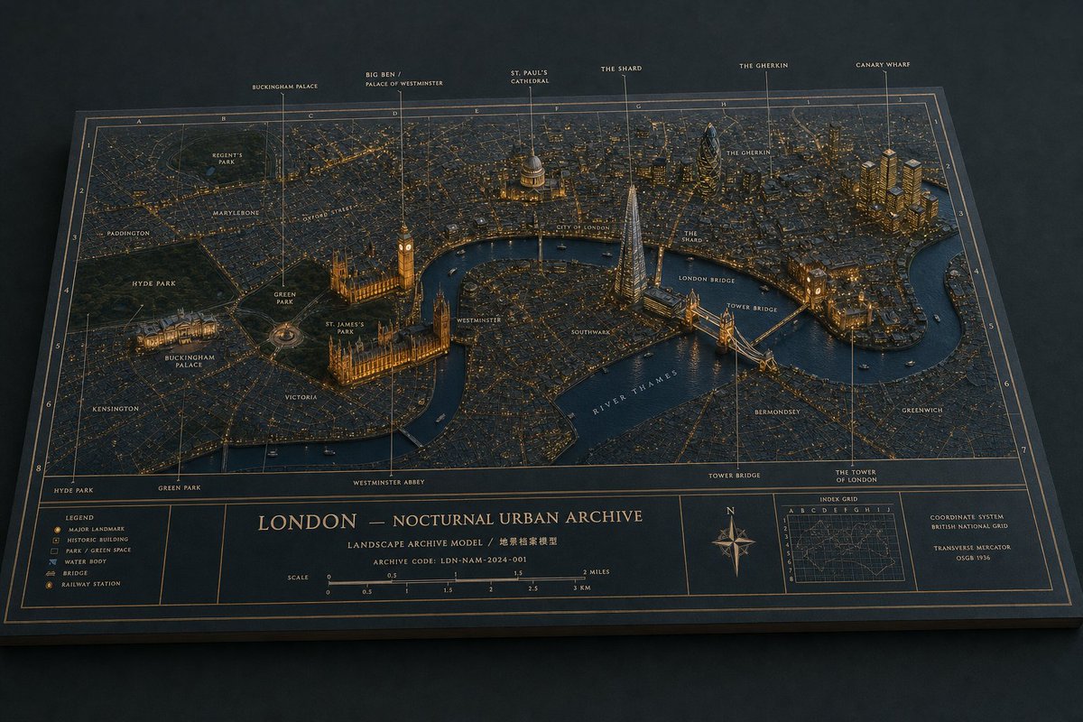
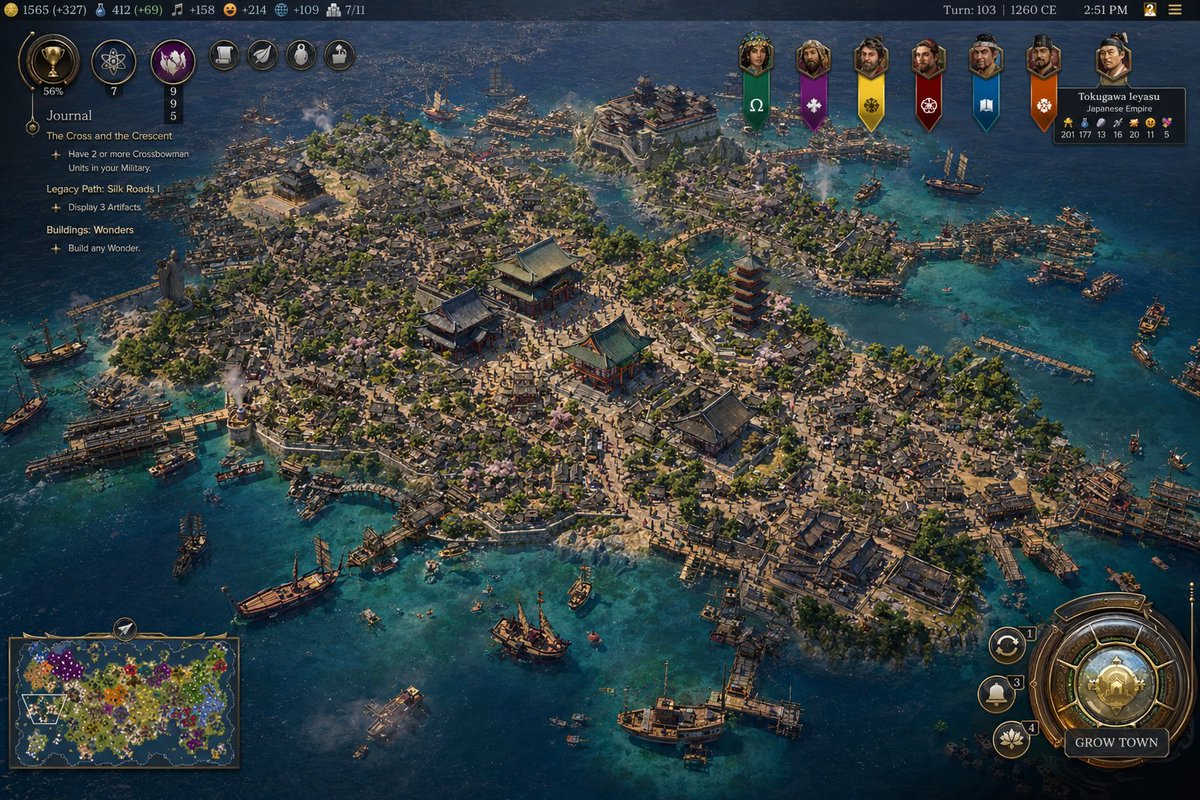
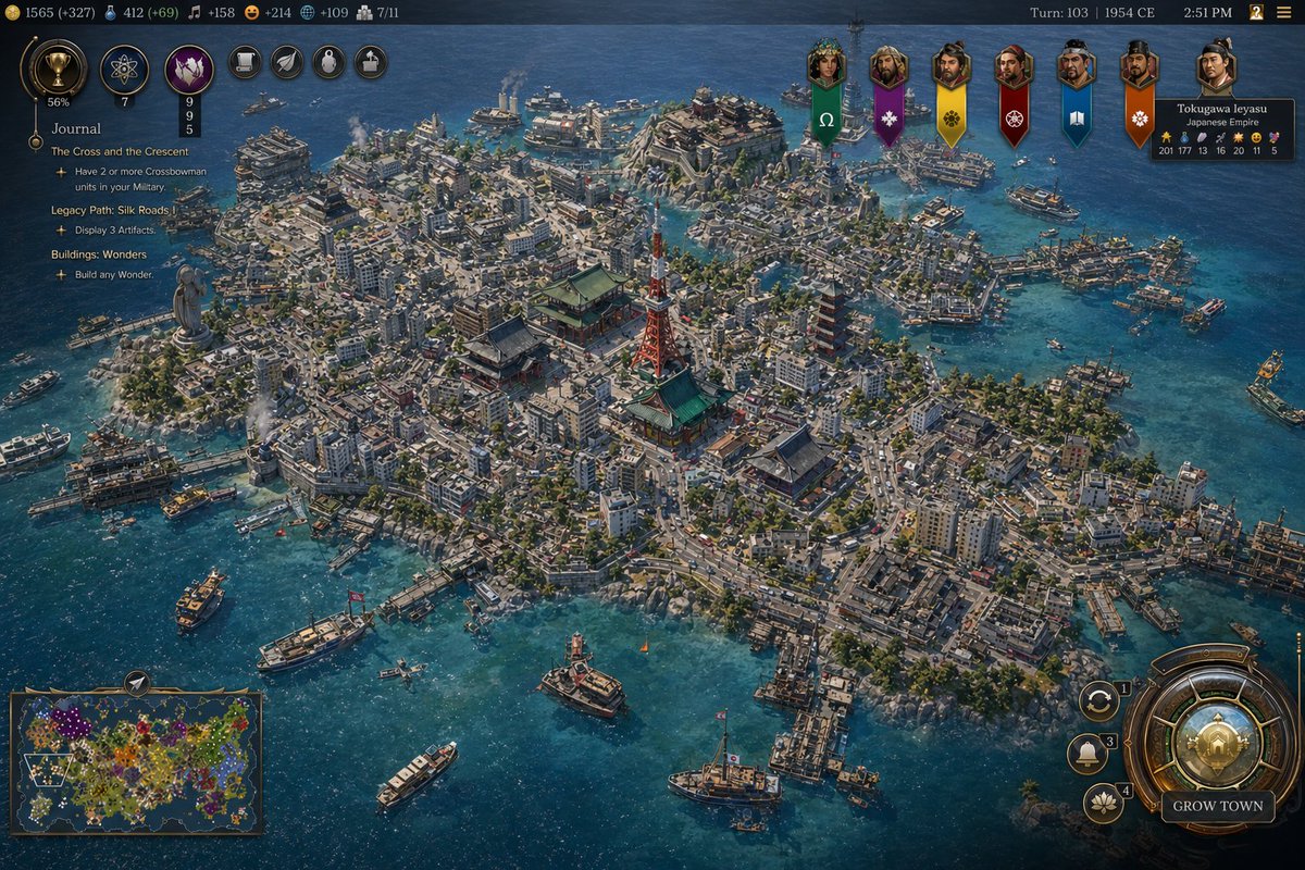
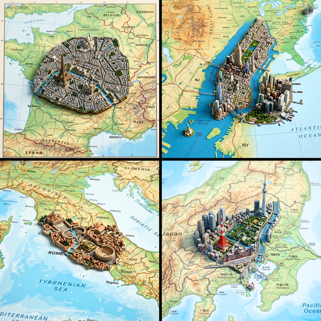
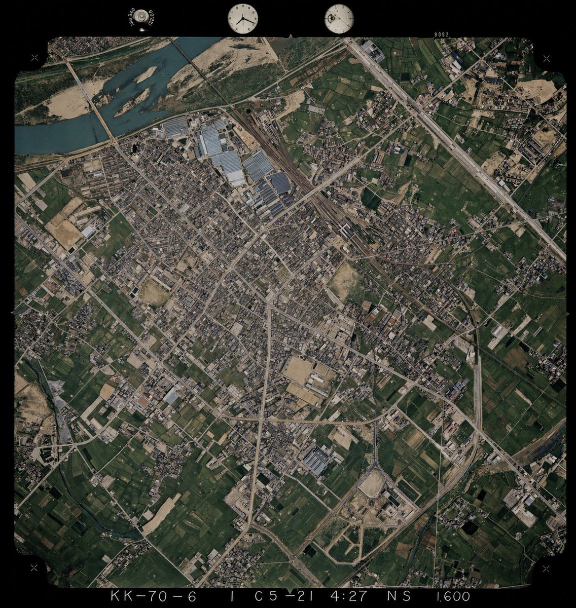
Using REFERENCE_0 as the base image, colorize the monochrome historical aerial photograph while preserving the exact original framing, angle, scale, film border, edge markings, and all geographic structures. Use REFERENCE_1 only as a color-reference guide for plausible land-surface colors seen from above. Keep the old photo’s layout and terrain details unchanged, but infer naturalistic colors for 4 major surface types: river water in muted blue-green, vegetation and farmland in varied dark greens, bare soil/sand and construction areas in tan-beige, and roads/buildings/industrial roofs in subdued gray to light brown. Maintain a realistic archival aerial-photo look rather than a modern satellite style, with slightly restrained saturation, subtle contrast, and consistent coloring across the whole scene.
Translations
为历史航拍照片上色
enUsing REFERENCE_0 as the base image, colorize the monochrome historical aerial photograph while preserving the exact original framing, angle, scale, film border, edge markings, and all geographic structures. Use REFERENCE_1 only as a color-reference guide for plausible land-surface colors seen from above. Keep the old photo’s layout and terrain details unchanged, but infer naturalistic colors for 4 major surface types: river water in muted blue-green, vegetation and farmland in varied dark greens, bare soil/sand and construction areas in tan-beige, and roads/buildings/industrial roofs in subdued gray to light brown. Maintain a realistic archival aerial-photo look rather than a modern satellite style, with slightly restrained saturation, subtle contrast, and consistent coloring across the whole scene.
为历史航拍照片上色
zh-CN以 REFERENCE_0 为底图,为单色历史航拍照片上色,同时保留原始的构图、角度、比例、胶片边框、边缘标记以及所有地理结构。仅将 REFERENCE_1 作为从高空俯瞰时的地表颜色参考指南。保持旧照片的布局和地形细节不变,但需推断出 4 种主要地表类型的自然色彩:河流为柔和的蓝绿色,植被和农田为深浅不一的深绿色,裸露土壤/沙地和建筑区域为棕褐色,道路/建筑物/工业屋顶为低饱和度的灰色至浅棕色。保持写实的档案级航拍照片质感,而非现代卫星图像风格,确保色彩饱和度适中、对比度微妙,并使整张图像的色彩保持一致。